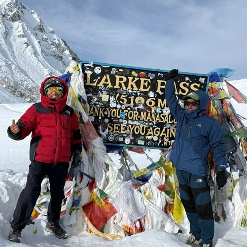
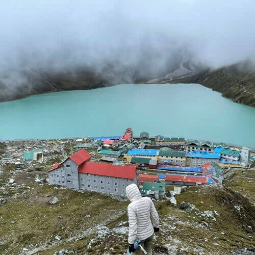
The Manaslu Circuit Trek is one of the best treks in Nepal, which is considered challenging yet worthwhile. Walking through Manaslu Conservation Area and enjoying the surreal charm of pristine natural attractions around Mt. Manaslu (8163 m), the eighth highest mountain, is a once-in-a-lifetime experience. For those looking to explore the Manaslu region in 2026/2027, one of the most useful tools is a route map that helps for a clear overview of the trekking trails.
Get a comprehensive guideline for this Manaslu trek, including key stops, elevation profile, hiking distances, surrounding mountains, rivers, and difficulty level. Make sure that you know from the initial point of the trip to major highlights that should not be missed. For more details, you can simply contact us, as we are here at Green Society Adventure here in your service.
Table of Contents
What is the Manaslu Circuit Trek route on the map for 2026/2027?
Generally, the Manaslu Circuit Route refers to a trail that circumnavigates Mt Manaslu. While vistas of Himalayan ranges and the struggles of crossing Larkya La Pass (5106 m/16,752 ft) are the same, the trekking trail may vary based on trail condition, initial point, and road access. The traditional Manaslu Circuit route starts from Soti Khola (700 m), passes through the villages of Nubri, crosses Larkya La Pass, and then joins the trail to the Annapurna region after Bhimthang.
The route still begins by entering the Budhi Gandaki River Valley, following an anticlockwise direction from east to west, with Machhakhola (870 m) as the starting point. You will gain elevation gradually at an appropriate pace, allowing your body a sufficient period to adapt to the environment of alpine landscapes. Our guide usually leads you along the route of the standard trail, except in cases regarding road conditions or trasportation arrangements.
The standard Manaslu Circuit Trek Map can be summarized as follows:
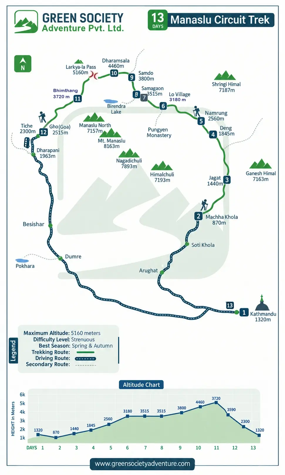
You can also see below the route in the map and elevation profile.
Manaslu Circuit Trek Route Map
How does the Manaslu Circuit Trek route map help you plan your journey?
Unless you know the geographical structure of the destination along with the altitude and trekking distance that you have chosen, it is quite impossible to plan your itinerary and prepare for dealing with potential challenges. A carefully designed Manaslu Circuit Trek route map makes it easier to continue through alternative paths in case of major trail blocking.
With the help of the map, trekkers can determine the time to reach rest stops, keep up on trail conditions, and get weather forecasts. Being aware of daily trek distance and elevation from one location to another, trekkers can easily maintain walking pace and plan for acclimatization systematically. The map also becomes very beneficial in case of emergency evacuation to tell the rescue team about the location.
The itinerary for the Manaslu Circuit trek explains the travel schedule day by day, including daily hiking distances, durations, locations of lodging, adventure activities, and served meals in a day. On the other hand, the map shows the journey in stages separately to better understand the regional structure. A pictorial overview really helps you to see where the day trek begins and ends. The overall trekking distance around Mt. Manaslu is approximately 150 km to 200 km based on side trips and chosen trails.
As illustrated in the map including elevations, you can understand why covering similar hiking distances has different durations (more or fewer hours). Observing the map, you can understand why covering 23 kilometers from Machha Khola to Jagat (lower-altitude landmarks) takes only 6–7 hours, while covering 16–18 kilometers from Dharamsala to Bimthang (crossing the highest point of the trek) takes about 8 to 10 hours.
The difference lies in steepness, trail surface (glacial moraine and snow), and the slowing influence of low oxygen availability. Since the map separates non-walking hours from walking hours, it helps you plan your daily travel schedule more conveniently.
What does the Manaslu Trek altitude chart reveal about acclimatization?
Instead of traversing the high mountain pass directly, the Manaslu Circuit trek elevation profile on the map shows that trekkers have a rest day at Samagaon on the 8th day of the trek. A rest day does not mean sitting at a teahouse all day but preparing for Larkya La Pass (5106 m). Therefore, the itinerary highlights side hikes to Manaslu Base Camp (4800 m) or Birendra Lake (3691 m), nearby destinations that you can see on the route map.
These are optional excursions, but we strongly recommend them, as we have designed the schedule with the trekking strategy of “Climb high, sleep low." After Samagaon: the trail takes you toward Samdo, and then a night at Dharmashala before the highest point of the trek. The chart shows that there will be gradual ascents and descents, allowing trekkers to prepare mentally too. Unlike compressed itineraries that reduce the trekking duration but increase the possibility of high altitude sickness, our 13-day Manaslu Circuit itinerary follows safe altitude-adjustment plans.
While the largest net elevation gain between overnight destinations is approximately 830 m (Deng to Namrung), the smallest net elevation gain is about 330 m (Samagaon to Samdo). As a result, sleeping elevation rises gradually, which you can see vividly on the map.
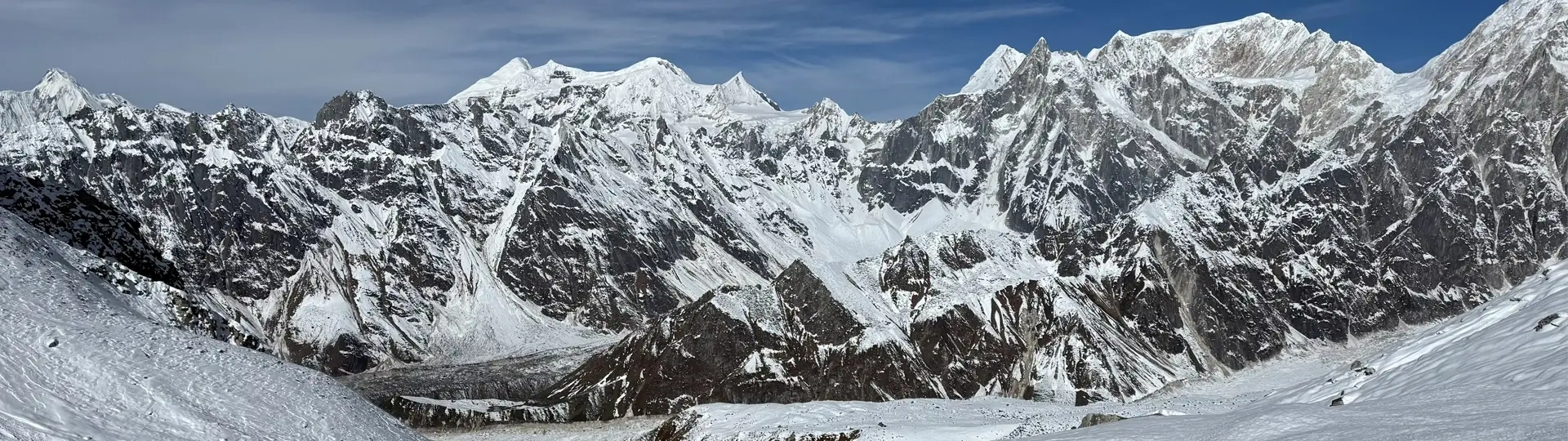
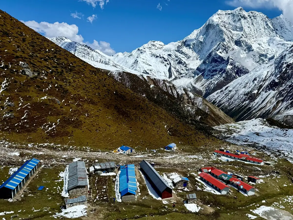
Beaufiful scenery on the Manaslu Circuit Route
How hard is the Larkya La Pass crossing on the Manaslu Circuit Trek map?
If it were easy, everyone would want to reach the summit of Mt. Everest (8848 m), the highest peak in the world. Whereas hiking over the Larkya La Pass is not as demanding as a mountain expedition, you feel quite difficult compared to previous days. Even though trails consist of rugged terrain with steep ascents and descents, you do not need any mountaineering skills and gears. However, unpredictable weather, low levels of oxygen, and longer distances for many hours (8 to 10 hours) make this the hardest day of the trek.
Our guide usually arranges an early morning (4 to 5 A.M.) trek departure to avoid harsh weather (strong wind/snowfall). Since the temperature drops to -10°C (14°F) or lower, you should wear layered clothes (base, mid, and outer) of premium quality to save yourself from cold issues. If you are a seasoned trekker, covering about 24 km is not a big deal with proper preparation. Nevertheless, novice ones need more caution, as reaching above 5000 metres is not only dealing with thin air but also keeping you strong enough emotionally to continue the journey.
Your walking speed becomes slower on narrower, rocky paths, although you have done aerobic exercises for 8 to 12 weeks. All you need is confident and patience on this day to overcome altitude sickness and other problems while passing Larkya Pass. Along with challenges, your soul flies high when your eyes get to savor the beauty of Himalayan ranges such as Mt. Manaslu, Annapurna II, Himlung Himal, and Cheo Himal.
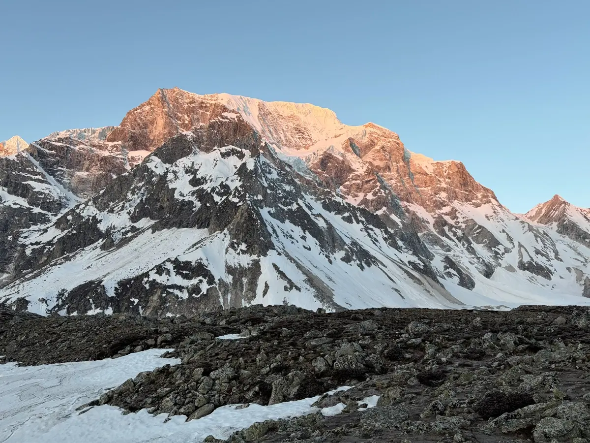
Magnificent View of Mt. Manaslu
Which villages and overnight shelters are shown on the Manaslu Circuit trek map?
Leaving the chaos of Kathmandu, a long drive of approximately 7-8 hours takes you to Machhakhola, the initial point to continue the trek along the Manaslu Circuit route. The map includes every major village, sleeping stop, and key destination without displaying all local settlements you pass along the way. Below, I have listed all the villages along with their elevations.
Village
Elevation
Machhakhola (First Overnight Stay)
870 m
Jagat (traditional village before entering restricted areas of Manaslu)
1440 m
Deng
1845 m
Namrung (the trekkers start getting more impressive scenery from here)
2560 m
Lho Village (a Tibetan-influenced small village near the Pungyen Monastery route)
3180 m
Samagaon (beautiful village where you have an acclimatization day)
3515 m
Samdo (a more Tibetan-influenced settlement nearby the Tibet-Nepal border)
3800 m
DharmaShala/Larkya Phedi (a final sleeping stop before crossing the Larkya Pass)
4460 m
Bhimthang (a small but scenic village after crossing Larkya La Pass, located on the western side of the pass)
3590 m
Gho
2515 m
Tilche (the end point of the Manaslu Circuit Trek, from where you will drive back to Kathmandu)
2300 m
Expect simple yet comfortable teahouses on the Manaslu circuit route, generally run by locals. Experience a traditional village lifestyle where facilities are basic, but you will get fresh, hot meals and warm hospitality.
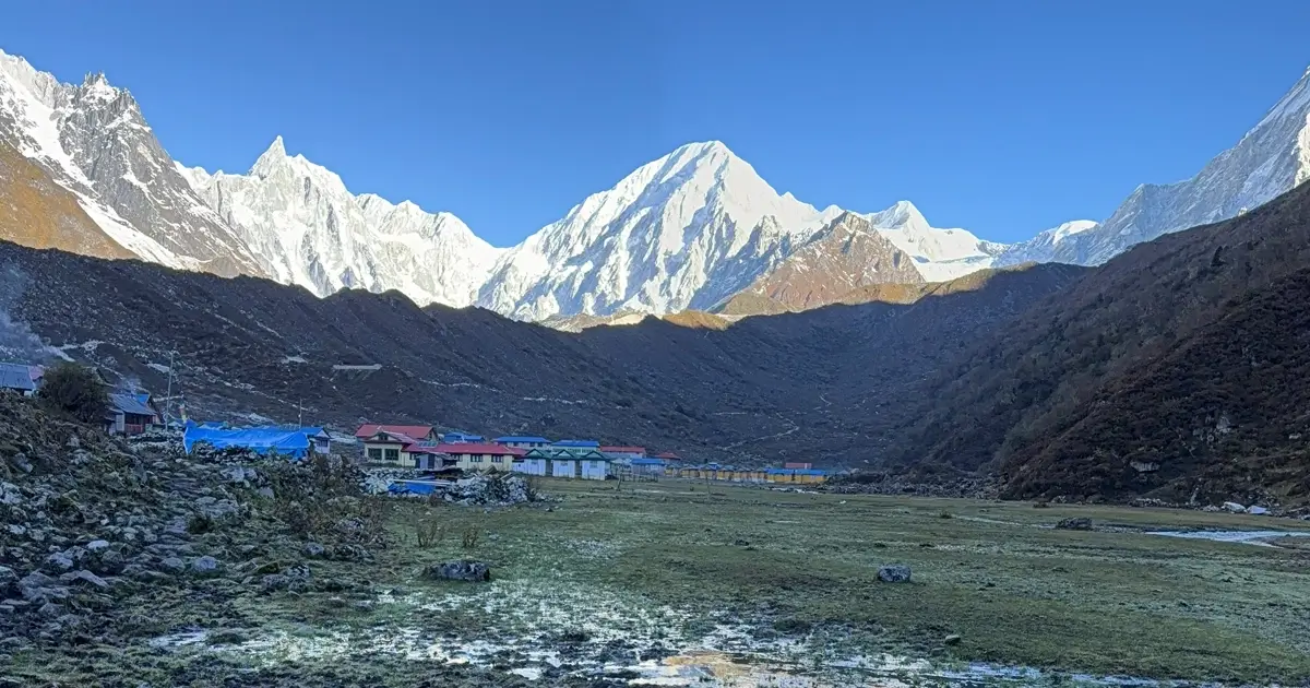
One of Villages on the Manaslu Circuit Trails
How to read the Manaslu Circuit route map for navigation, and when to check it?
Obviously, you must follow your licensed guide during the trek, but reading the map while trekking in the Manaslu region helps you conform to where you are and what comes in the next phase. Reading the map matters as soon as you start trekking from Machhakhola, but you must read it carefully after Samdo, where networks are unreliable in some places.
Before beginning a day hike, you should read terrain logic, not only distance. During the first five days of the trek, the BudhiGandaki River can become your natural compass. The trail takes you through a gorge and suspension bridges. Since the Larkya Pass is not a single point, you need to pass a slope in about an hour. A Manaslu Circuit trail map is essential for identifying the approach to Larkya La Pass, but it should not be relied upon more than the expertise of a guide.
However, you need to know when to check the route map. If you are wondering, when should you check the map? We recommend you keep it handy at all times. Check the map the night before each trekking day, and discuss confusing junctions. Repeatedly verify (for ten to fifteen minutes while walking) to make sure that you are on the right path. Look at the map at every bridge, crossroads, and permit checkpoint before continuing.
Are digital or printed maps better for the Manaslu Circuit Trek?
We recommend you carry both the digital and hard copy Manaslu Circuit route maps. While GPS digital maps have a significant influence on trail navigation, traditional printed maps are a backup. Offline digital maps in Gaia, Maps. me are particularly useful when you reach isolated areas. GPS positioning functions even with no internet, and because of the displayed data (distance and detailed terrain), you will know how to locate villages, junctions, and right paths easily.
In lower elevations, the teahouse provides services of device charging, and your power banks are also helpful to use for mapping conveniently. After Samdo, printed maps become more useful in the lack of electricity and less battery life due to cold. Therefore, carrying a waterproof map that does not require any power can be a wise idea along with a digital map during your dream trek.
Day-by-day route table: villages, distances, and walking times
The trekking distances and walking hours may vary based on the particular travel schedule, but you can see the following table, which helps for the trek's preparation.
Start from/to
Distance(kilometers/miles)
Trekking Duration (hours)
Machhakhola to Jagat
20–22 km (12.4–13.7 miles)
6-7
Jagat to Deng
21/13.1
7-8
Deng to Namrung
20/12.5
6-7 hours
Namrung to Lho
12/7.5
4-5
Lho to Samagaon
9/5.6
4-5
Acclimatization Day at Samagaon and hike to Birendra Lake or Manaslu Base Camp
3–4 (1.9–2.5 miles)
or 12–15 (7.5–9.3 miles)
1.5-3
or 6-9
Samagaon to Samdo
7/4.3
3-4
Samdo to Dharmashala
6/3.7
3-4
Dharmashala to Bhimthang via Larkya La Pass
16-18 /9.94 to 11.18
8-10 hours
Bhimthang to Tiliche
16-20/10-12
5-6
Can you extend the Manaslu Circuit Trek?
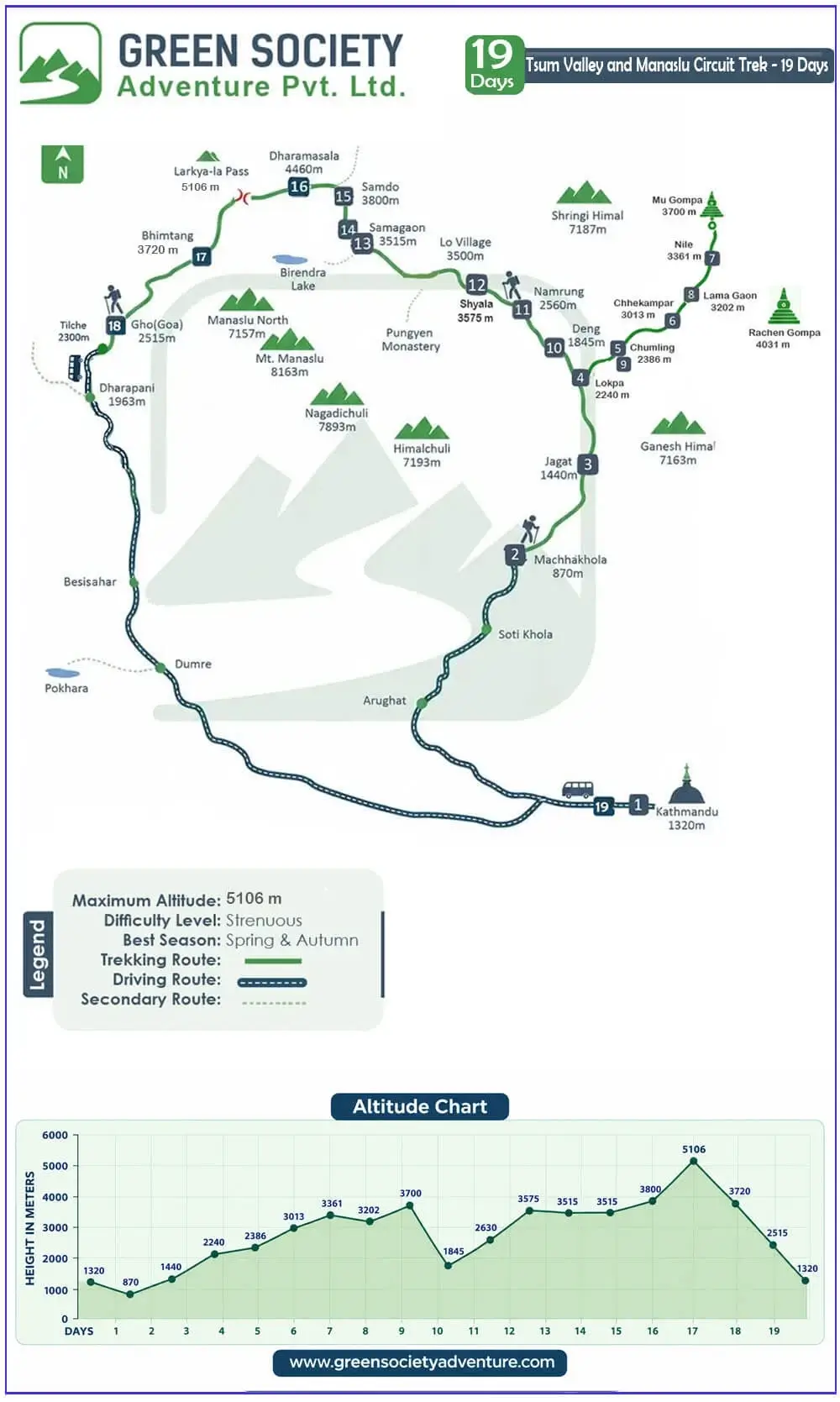
Yes, you can extend the Manaslu circuit trek by spending more days at Samagaon and Samdo, including side hikes. Nevertheless, it can also be combined with either the Annapurna Circuit or the Tsum Valley. If you want to do the Manaslu Circuit with the Annapurna Circuit, it may take approximately 19 to 23 days, while the Tsum Valley Manaslu Circuit only takes 18 to 21 days to complete.
Tsum Valley is rich in Tibetan culture and also falls under restricted areas in Nepal, requiring another separate entry permit along with the Tsum Nubri Rural Municipality Permit. Similarly, you also need an Annapurna Conservation Area Permit while combining the Manaslu route with the Annapurna Circuit. We have a package for theTsum Valley and Manaslu Circuit Trek—19 days. You can say it’s the map below.
Tsum Valley Trek with Manaslu Circuit
Conclusion
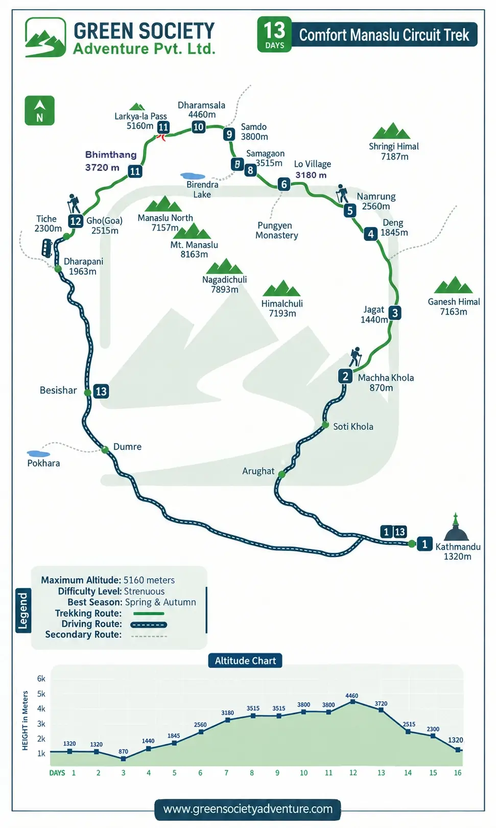
The Manaslu Circuit Route Map is mandatory in your packing list. As a result, we have provided you all information about trails, elevations, key stops, and highlights of the trek. If you expect this information to answer all your questions regarding the circuit trek, our team at Green Society Adventure promises to provide you with excellent services, even in remote areas. If you are planning to trek in 2026/2027, you can contact us by email or WhatsApp. We also offer the Comfort Manaslu Circuit Trek Package if you prefer to experience the Manaslu trek in a more comfortable manner.
Map of Comfort Manaslu Circuit Trek Route
Comfort Manaslu Circuit trek Route Map
FAQs
How Challenging is Manaslu Circuit Trek?
Manaslu trek is challenging due to the high pass (over 5000m) that must be crossed. It is recommended for those who enjoy the outdoors, are physically fit, and have good health, and patience. Physical exercise is recommended before starting the trip as it takes place at a high altitude.
What Types of Accommodation Do We Get During the Trek?
On most of the areas in this trek, clean and comfortable guests house, and lodges are provided. Few places rooms with attached bathrooms can be available.
How to Avoid High Altitude Sickness During the Manaslu Circuit Trek?
Hike (Ascend) slowly.
Avoid Tobacco and Alcohol
Take a rest and take a deep breath.
Drink plenty of water and fluids and stay hydrated.
Walk on high and sleep at a low altitude.
Take Diamox or Tylenol.
Where Do I Store My Extra Luggage While I’m on the Manaslu Trek?
You can place it at our office or store it at your hotel (generally the hotels in Kathmandu have storage services).
Does Manaslu Trek Require Previous Experience
Well, if you have a healthy circulatory ability and enough strength to cope with high altitude, then it doesn’t require early experience. However, if you have experience in trekking or hiking then you can enjoy your Himalayan adventure maximum!
Raj Kumar Khadka
Raj Kumar was born and raised in the mountain town of Gorkha. He is an enthusiastic traveler who enjoys discovering new places. His passion for exploration knows no bounds, driving him to seek out new trails and experiences. He has successfully traveled and explored most of the trekking routes in Nepal, mastering their intricacies.
Raj Kumar started his career as a guide at the end of the year 2006. His dedication to this field has been unwavering, surpassing 17 years and counting. He established his own company, Green Society Adventure, in 2013, fueled by his expertise and entrepreneurial spirit. He has a vision to share the beauty of Nepal’s landscapes and cultures to the world. As both a guide and a leader, he inspires people to explore the world with curiosity and respect.