The Gokyo Valley Trekking, a quieter route compared to the Everest Base Camp (EBC) Trek, is gratifying whether you trek up to Gokyo Ri (5357 m) or extend it by reaching EBC (5364 m) and Kalapathhar (5644 m) via Cho La Pass (5360 m). A detailed route plays a key role in making this iconic odyssey successful by helping trekkers avoid several challenges, including unforeseen circumstances caused by the erratic weather of the Himalayas.
Read our latest blog, which highlights accurate major trails, starting points, pausing stops, vantage points, mountains, villages, and daily hiking distance along with elevation profiles. Without the stress of getting lost, savor the charm of the surreal nature as well as have a deep insight into Sherpas, who are usually known as the backbone of Himalayan expeditions.
Learn the value of the Gokyo Valley Trek Map with elevation, and choose the one that suits your physical fitness level, preferences, and budget in your account. For more details about packages, contact us on WhatsApp or send an email. However, get a move on to reach your dream trekking destination, as peak season (spring) is drawing near.
Table of Contents
What is the Gokyo Valley Trek route?
The route to Gokyo Valley is recently popular among adventurers, and it has become an alternative trail to several Khumbu region trekking trails. After flying from the capital city to Tenzing Hillary Airport, Lukla (2860 m), the path to EBC and Gokyo is shared up to Namche Bazar, a Sherpa town. From here, some head towards Tengboche and Lobuche in order to reach the foothills of Mt. Everest (8848 m), and trekkers continue northwest toward Dole to the wilderness of the Gokyo Lakes via Machhermo.
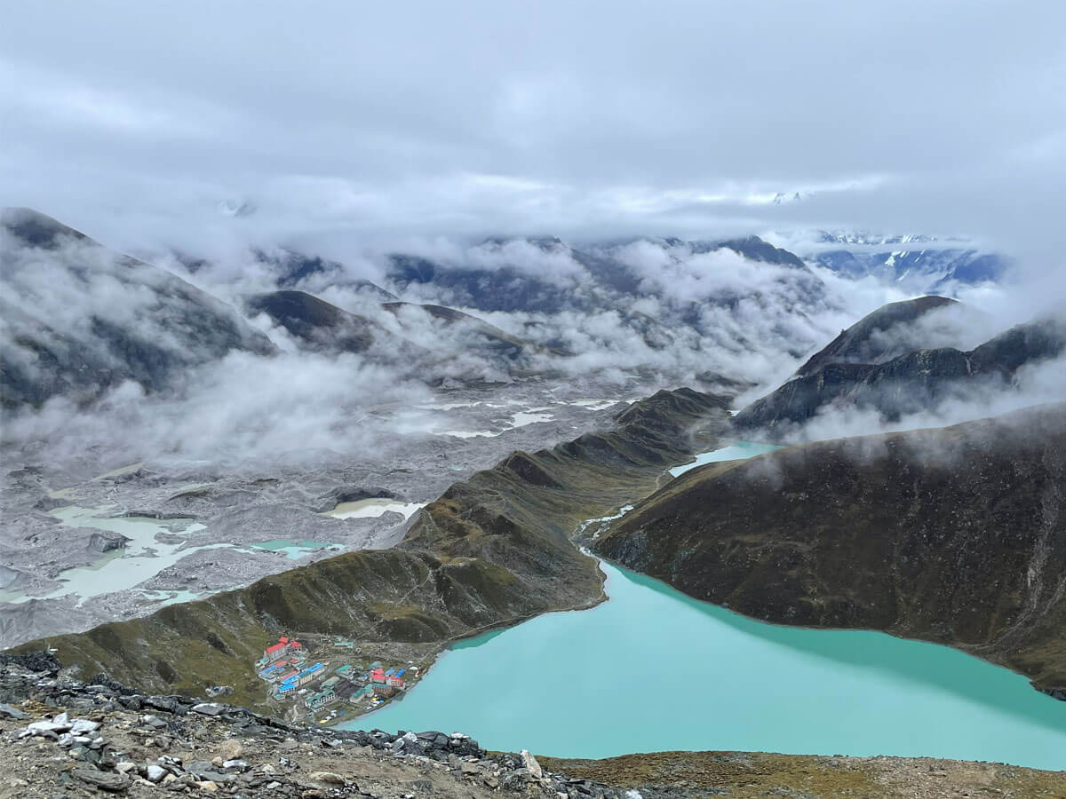
Generally, the Gokyo Valley trekking route passes through quaint, traditional Sherpa villages, high alpine grazing lands; the mighty Ngozumpa Glacier; panoramic vistas from Gokyo Ri; and a cluster of turquoise lakes.
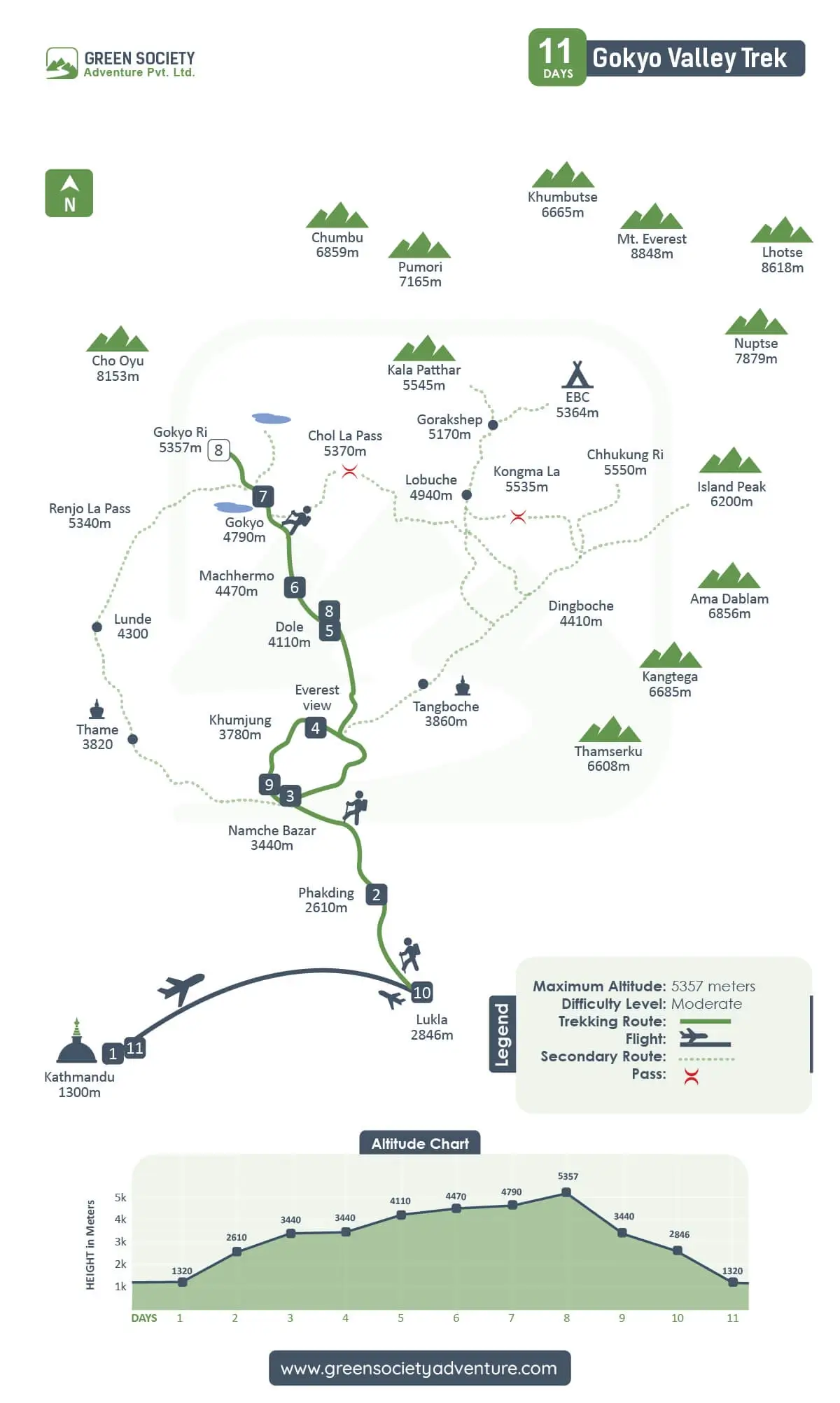
Gokyo Valley Trekking Route Map
Why do you need the Gokyo Trek Map?
Generally, trekking companies of Nepal provide a seasoned guide who knows about trails, local places, and weather patterns even if there is not a detailed map. Following the team leader’s instruction, the itinerary, and a Gokyo Valley trek map with elevation profiles ensures that you are making the right moves. Accordingly, do not miss the map along with the GPS tool and compass for proper navigation. Make your journey notable with extensive insight into the trails that helps to estimate daily trekking distance and hours, together with cautions for safety and well-being.
In case a major path gets blocked due to landslides, floods, and avalanches, forcing you to return or choose a short but demanding alternative way. A clear map shows you longer/shorter and dangerous or safer routes to select the best one for you compared to the others. The Gokyo Valley trekking route map guarantees the total hiking distance, daily trekking length, and elevation gains for each day. The trip becomes easier by knowing about teahouses, major settlements, and the structure of geography.
Regulate your walking pace and climb up to higher mountainous landmarks, avoiding excessive mental and physical fatigue after knowing the weather pattern and trail conditions through Gokyo Valley Trek Route Overview. During the months of the optimal period (spring and autumn), teahouses become full, while the teahouse owners migrate to lower elevations to skip the harsh cold of winter and challenges of the monsoon. At that time, a guide can search for appropriate accommodation with the help of a map, which can satisfy all trekkers with services.
Where Does the Gokyo Valley Trek Route Go?
Start this wonderful trip from Lukla, the gateway to the Everest Base Camp, with gradual ascents alongside the Dudh Koshi Valley. The trail takes you through dense forests of the Sagarmatha National Park, a UNESCO World Natural Heritage site, providing glimpses of rare flora and fauna, including rhododendrons, oaks, Himalayan tahr, and langur monkeys.
The Gokyo Valley trek route map shows all villages that you pass to reach the trekking destination. It shows that the route contains both moderate and quite demanding paths, and you can prepare yourself by observing the map carefully before venturing into the trek. The main route of the 11-day Gokyo trek follows Lukla → Phakding → Namche Bazaar → Dole → Machhermo → Gokyo Village → Gokyo Ri, and then back to Lukla, taking the same path to return to the Kathmandu Valley.
How Long Is the Gokyo Valley Trail Distance?
As the Gokyo Valley Trek route map evidently displays initial points and the destination of the day, the guide and trekker can know the hiking distances and plan to cover them in a manageable way. The approximate one-way distance of the official hike from Lukla to Gokyo Ri is 47 to 50 km, and the distance of the round trip is roughly 95 km, which takes 10 to 14 days to complete depending on you.
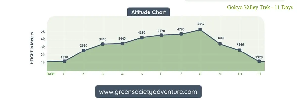
Gokyo Valley Altitude Chart
What Is the Gokyo Valley Elevation Profile?
Knowing the elevation gain from one stop to another destination for overnight is fundamental during the trek to prepare yourself to adapt to the environment naturally. Since there is a risk of acute mountain sickness above 2500 m from sea level due to the low level of oxygen, gradually ascend to higher lands. Although trekking companies design the itinerary, including acclimatization day, ask for adding extra days. If you feel some symptoms of altitude sickness, know health is the first priority.
The map has also shown difficulty level, passes, and secondary routes, which helps you to characterize the trails’ conditions and makes you alert to steep or demanding paths. Knowing gradual elevation gains helps you to cover hiking distances with a comfortable pace and rest days, avoiding critical cases caused by thin air. Below we have provided an Gokyo Valley Elevation Profile for vivid visualization.
What Are the Key Gokyo Valley Trail Stops?
Key stops of the Gokyo Valley route are also mentioned on the route, helping you to choose the best one that has more comfortable teahouses with cozy rooms and essential amenities, even if there is no modern furniture or advanced facilities. We have explained below the key stops on the Gokyo Valley route.
Phakding
At the teahouse of Phakding, you spend the first night in the Khumbu region after trekking for 3 hours from Lukla, covering roughly 6.2 km. This small but peaceful hamlet is situated beside the Dudh Koshi River at an elevation of 2610 m, which is a gentler altitude than other points along the Everest Trail. Enjoy the scenery of the surroundings, which starts introducing the beauty of the Everest region.
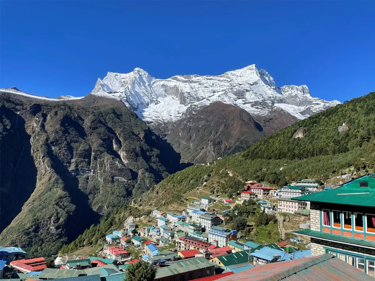
Astonishing view of Namche Bazar
Namche Bazar
Namche Bazaar is a bustling settlement on the Everest route that has more advanced facilities. When you reach there after walking for 5 to 6 hours, covering 10.8 km, you will see many trekkers, guides, and porters, together with delightful faces of locals in their own attire. You can buy missing equipment here and also take health services.
If needed, as this place has some more facilities and hospitals. Monasteries, gompas, and the serenity of nighttime provide you satisfaction from within, along with unique traditions. On this day, you have to verify the Sagarmatha National Park entry permit at Monjo before reaching Namche Bazar.
Dole
This will be your first night above 4000 m, enjoying the beauty of Dole after an acclimatization at Namche Bazar. Less crowded points offer you closer and unobstructed views of towering mountains, allowing you to have wonderful photographs, especially during dawn and dusk. Prepare yourself here before heading towards more rugged and steep sections to reach the valley of Gokyo. On this day, the trail splits from the EBC trekking route and leads to more rough landmarks as well as alpine meadows and yak pasturelands.
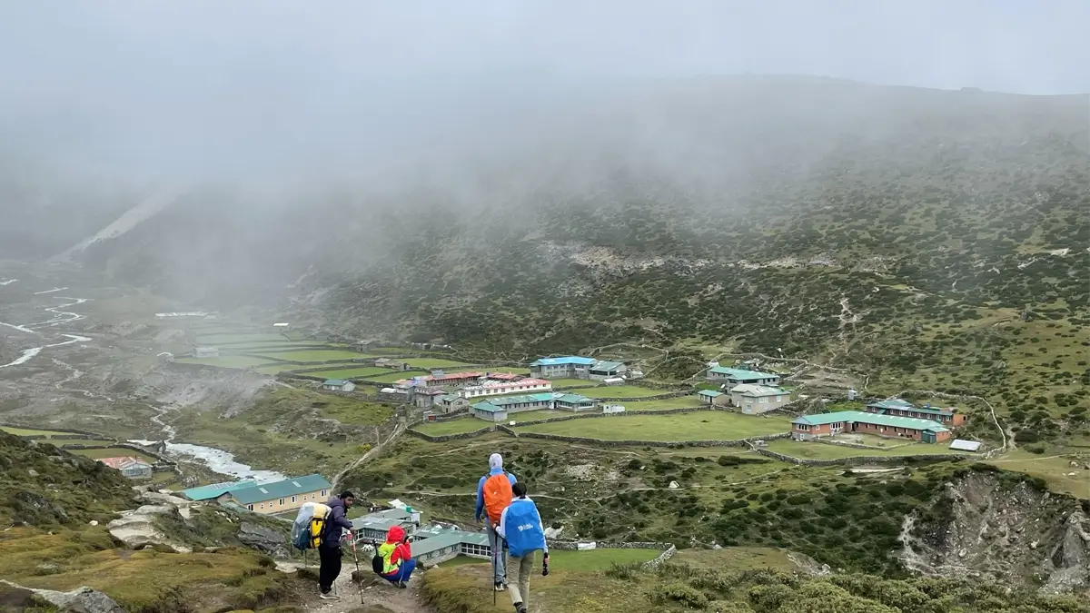
Trekkers at Machhermo, a quaint hamlet on the route
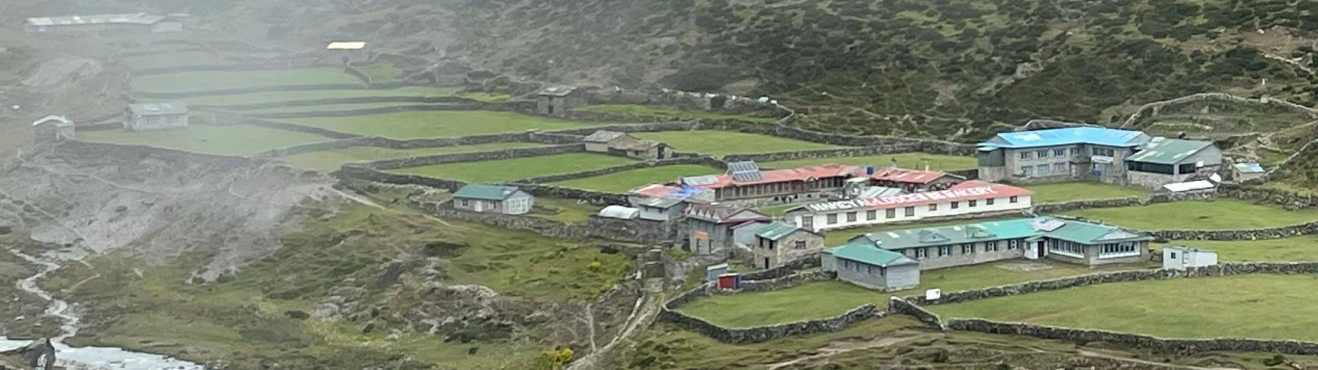
Machhermo
Machhermo is a tiny village, sitting at an elevation of 4470 m in an open valley and often known as a safe and popular stop in the Everest region on the route to Gokyo Lakes that serves many trekkers. Learn here Himalayan cultures, as Sherpas have preserved centuries-old traditions, usually influenced by Tibetan Buddhism.
Gokyo Village
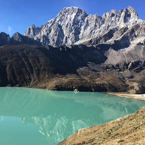
Gokyo Village is one of the highlights of the trek, situated near the crystal-clear, third Gokyo Lake, offering wonderful scenery. Crossing some settlements and Ngozumpa Glacier, as well as walking alongside the first Gokyo Lake (Longpongo) and the second Gokyo Lake (Taboche Tsho), leads to this serene haven. Gaining elevation of almost 600 m, reach the summit of Gokyo Ri, the most anticipated vantage point of the trek.
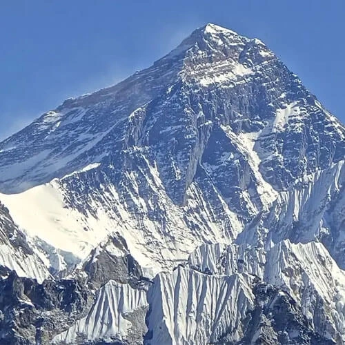
Spend there quality time with fellow trekkers, savoring the beauty of the magnificent atmosphere and awe-inspiring panoramas of Mt. Everest (8848 m), Cholatse (6440 m), Taweche (6542 m), Kantega (6685 m), Thamserku (6808 m), Guangcheng Kang (7922 m), Lhotse (8501 m), Makalu (8475 m), and Lobuche (6145 m). The breathtaking scenery of Ngozumpa Glacier, Gokyo Valley, and rugged hills encourages you to capture them on your camera roll. The most popular at Gokyo Ri is sunrise and sunset over the Himalayas, which is comparable to the view from Kala Patthar (5844 m).
When should you check the Gokyo trek map with elevation?
Trek preparation starts when you start comparing packages for the same destination you desire the most, which also includes checking the itinerary along with a detailed map with an elevation profile. Nepal trekking guides handle all logistics, and you do not have to worry about the route, as they keep updating on weather, trail condition, meals, and accommodation availability via teahouse owners and a team returning from Gokyo Valley or EBC.
However, ensuring the route map you are going through can provide mental peace and focus on the trek effectively is important. Accordingly, keep observing a map after the official trek begins from Lukla to confirm that you are taking the right steps and heading in the accurate direction. Carry the map in your daypack, and review rest points nearby., teahouses, elevation gain, and trekking distances to balance your hiking pace and duration of walk.
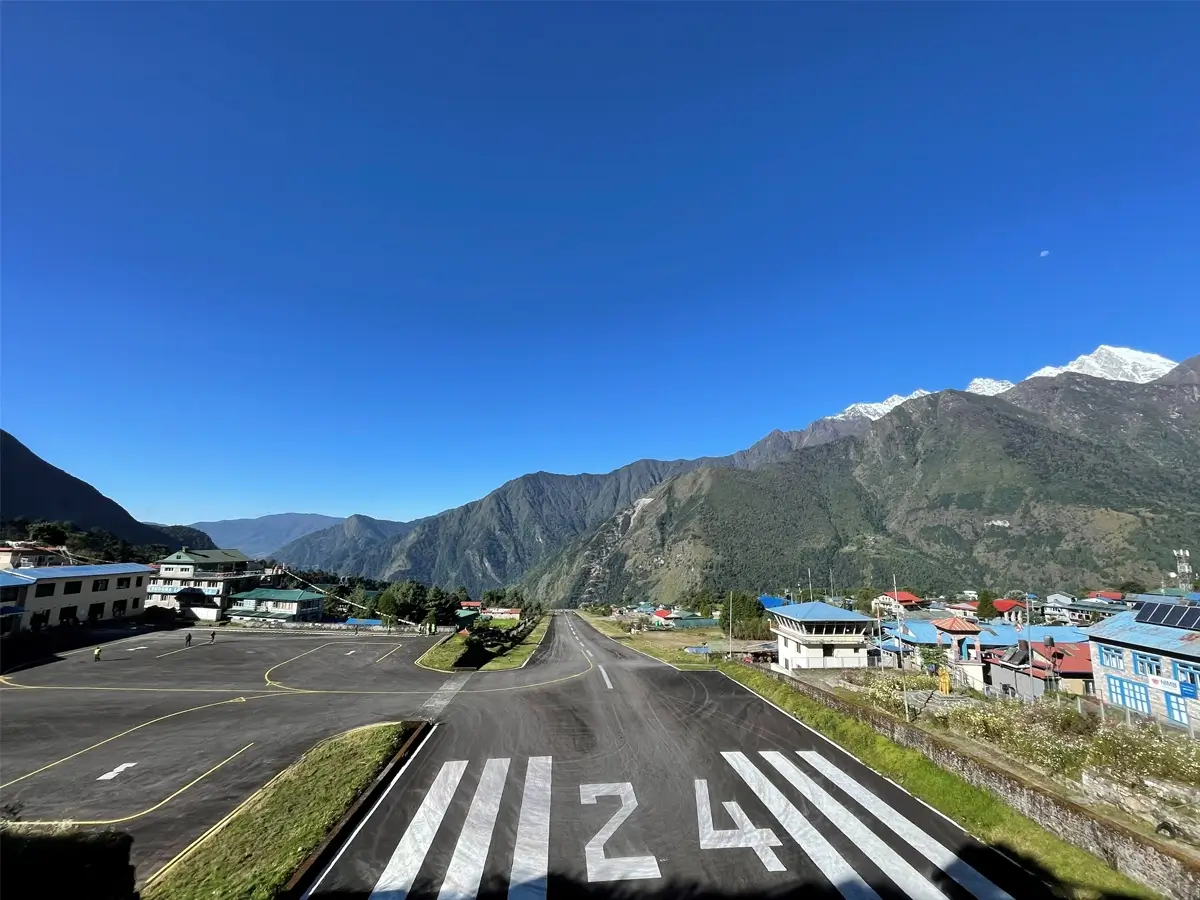
Tenzing Hillary Airport, Lukla
Keep the map handy at all times to reach the highlights of the trek on time, and continue the trip by knowing daily progress even if the trail is not well-marked by directional signs. Increase your confidence level by reviewing the Gokyo Valley route map from time to time, whether it’s an easier or challenging section with steep ascents and descents. Checking your current position using a GPS tool or a detailed, printed map can provide more mental preparedness.
How should the Gokyo Valley trekking route map be?
Maps of any trekking destinations should not have mistakes that misguide trekkers and lead to incidents happening on the path. The Gokyo trek map with elevation must include the clearly named key stops, starting point, major trail, secondary trail, elevation, highlights, indication of difficulty level of trekking, etc., which can be understood easily. For a safer and more comfortable trek, such a reliable map with a vivid elevation profile and landmark structure helps to identify risky territory.
Confirm that the map has included the current condition of the trail to avoid the case of returning home caused by reconstruction or road damage. An updated route overview lessens the risks of getting injured by choosing more strenuous alternative paths.
What kind of Gokyo Valley trek map should you carry?
Carrying a map itself is essential, whether it is a printed, traditional terrain map; an online/offline map; or distinct trekking apps based on Nepal’s trekking areas and routes. All kinds of Gokyo route maps have their own features with various significances. For example, while a hard copy of the hiking map with elevation profiles is more efficient for the isolated terrain of the Everest region with weak internet/poor connections, a digital GPS device can assist you with live movement records.
If you choose the Green Society Adventure, you will get reliable maps and also be suggested the best online apps. However, carry the best among them or carry both digital and printed maps for more accuracy without missing any, covering every important detail. To get rid of stress regarding the battery drain of electronic devices, carry a charger and power bank and use them. Keep in a backpack a waterproof and detailed Gokyo trek map that lasts long to use if an electronic one fails to function.
Search trekking companies’ websites that deliver downloadable maps that serve as handy references. Even though there are advanced digital tools, for instance, Gaia GPS, SW Maps, Hooker App, and GPS Nepal, carry a printed map along with a direction compass for navigation, as the chance of draining power of portable smart devices is higher in the severe cold of high elevations.
How will the map of the extended Gokyo Valley trek route be?
If you add 4 to 6 more days to the Gokyo Valley trek, you can combine it with the Everest Base Camp trek via Cho La Pass (5360 m). This journey is appropriate for those who love to test their physical endurance and mental resilience on the challenging terrain of high alpine passes and more strenuous routes to the base of Mt. Everest and Kalapathhar (5644 m). Compare the Gokyo Valley Trek Map along with the Everest Base Camp and Gokyo Lake Trek - 17 Days (extended version of the Gokyo Trek), then choose the best one for you.
Since the Gokyo trek itinerary is customizable like others, freely present your thoughts to us, and we will attempt to manage the best one for you. We prioritize your preferences together with safety throughout the adventure.
Map for the Everest Base Camp and Gokyo Lake Trek - 17 Days
How to obtain a map of the Gokyo Valley trek route?
Trekking companies (local, national, and international) provide trekking route maps with elevation profiles together with some hiking equipment. Green Society Adventure also offers a printed Gokyo Valley trek map for trekkers to ensure that the trip depends on the clearly scheduled itinerary. However, Nepal’s trekking agencies and tour operators or the Nepal Tourism Board office in Kathmandu can also provide digital maps for multiple trekking trails.
A Google search will provide online maps of the route, either in printable form or compatible with GPS devices.
Why select the Gokyo Valley Trek Route Instead of EBC?
The Gokyo Valley Trek route overview is one of the iconic Everest region hiking paths, which are peaceful and less traveled. Crystal-clear lakes and extensive views of Mt. Everest, Makalu, Cho Oyu, Lhotse, and Nuptse; following the flexible itinerary option can make it an unforgettable journey that creates long-lasting memories. Because of fewer crowds, you have more space to explore without disturbance as well as get teahouses and meals.
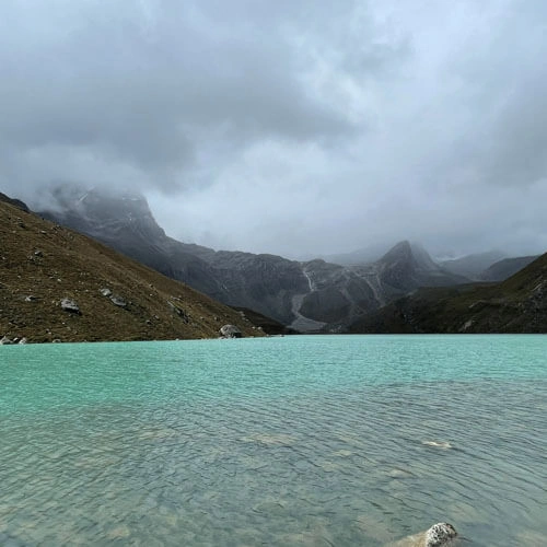
The highlights of the Gokyo trek are more similar to EBC trekking and more rewarding due to the blue lakes, named Gokyo, which are revered by both Hindus and Buddhists. Several pilgrims visit and come there for religious purposes, especially on the occasion of Janai Purnima. According to the local legends, Nagdevata (snake deity) lives in Dud Pokhari (Third Gokyo Lake).
Conclusion
To summarize, we recommend you carry a detailed Gokyo trek map with elevation that helps you to navigate the chosen trekking area in the Khumbu region to make 2026/2027 more enjoyable with your loved ones. If you want an easier or more challenging journey, the Green Society Adventure has different packages for Everest, Annapurna,Langtang, or other regions. Our licensed trekking guide always guarantees your safer trip, considering health situations and all arrangements for the trip.
Hurry for the trip to the peaceful Valley of the Gokyo, making it easier by carrying a digital or printed map along with direction devices. Enjoy 11 or 17 days around Sherpa villages, lush forests, towering Himalayas, and rugged hills without mental stress after reading our blog regarding Gokyo Valley trail stops and altitude charts.
Wonderful view of lakes from Gokyo Ri(5357m)
FAQs
What is the best time to trek to the Gokyo Valley?
Spring (March to May) and autumn (September to October) are the most optimal times of the year to embark on the Gokyo trek, even if it is doable year-round. Monsoon’s heavy rain and winter’s harsh cold can cause health problems as well as unexpected accidents on the way. Therefore, we recommend only peak seasons when skies get clearer, flowers bloom, the temperature becomes moderate, and the trail remains dry. If you are risk-takers and curious to trek during the offseasons, the best idea is choosing rainshadow areas like Upper Mustang, Upper Dolpo, or Nar Phu Valley.
What permits do you need for the Gokyo Valley trekking route?
For the Gokyo Valley trek, you have to obtain a Khumbu Pasang Lhamu Rural Municipality permit and a Sagarmatha National Park entry permit. On your behalf, Guide manages all essential paper documents, letting you focus only on the trip. These permits are not only to complete the legal process but also for guaranteeing your security, as administration collects all your details along with a detailed itinerary to track you and provide rescue in case of an emergency.
Accordingly, follow every rules, and also do not harm any living beings as the governments’ purpose of collecting funds for permit is also to use them for preserving creatures and vegetation of the areas, considering
How difficult is the Gokyo Valley trek?
The Gokyo Valley trek is considered a moderate journey, as it also has well-marked trails and comfortable teahouses, as well as a smooth itinerary and appropriate average duration and length of the trek. You may have symptoms of high altitude, such as headache, nausea, difficulty sleeping, fatigue, dizziness, shortness of breath, loss of appetite, etc., while trekking above 2500 m. However, precautions, along with physical and mental preparation, can assist in completing the journey easily.
What kind of meal and accommodation do you get on the route to Gokyo Valley?
On the way to Gokyo Valley, you will have to adjust to simple teahouses after leaving Namche Bazaar due to the limited services of isolated terrain. Rooms will be common, with cozy rooms having a twin bed, common furniture, and only basic amenities. Do not expect advanced facilities such as internet of strong connection, hot showers, attached bathrooms, and modern dining halls.
Have a common meal, mostly “Dal Bhat,” which consists of steamed rice, seasonal vegetables, pickles, and a salad. However, you also get Western and Tibetan food for instance pasta, omelets, pizza, fry rice, chowmein, thukpa, Tibetan bread, etc.
Why shuld you obtain travel insurance for the Gokyo trek?
Travel insurance is a must-have document for the Gokyo trekking route to be free from financial stress in case of getting injured or needing emergency helicopter evacuation, which is very expensive above 4000 m. If you have the right insurance that covers all medical treatment at the hospital, flight delay or cancellation, or loss or damage of personal belongings, you do not have to worry about financial burden.
Raj Kumar was born and raised in the mountain town of Gorkha. He is an enthusiastic traveler who enjoys discovering new places. His passion for exploration knows no bounds, driving him to seek out new trails and experiences. He has successfully traveled and explored most of the trekking routes in Nepal, mastering their intricacies.
Raj Kumar started his career as a guide at the end of the year 2006. His dedication to this field has been unwavering, surpassing 17 years and counting. He established his own company, Green Society Adventure, in 2013, fueled by his expertise and entrepreneurial spirit. He has a vision to share the beauty of Nepal’s landscapes and cultures to the world. As both a guide and a leader, he inspires people to explore the world with curiosity and respect.
.jpg)